Why it is worth riding
A remarkably smooth cross-panhandle rail-trail from Plummer through Chatcolet, Harrison and the Coeur d’Alene River valley to the mining towns of the Silver Valley.
A remarkably smooth cross-panhandle rail-trail from Plummer through Chatcolet, Harrison and the Coeur d’Alene River valley to the mining towns of the Silver Valley.
CORE INFORMATION
WHY IT’S FUN
The Trail of the Coeur d’Alenes is one of those rare routes whose scale never feels like mere mileage. Over 73.2 paved miles, it links the Palouse-edge town of Plummer with Lake Coeur d’Alene, the quiet river wetlands around Harrison and Cataldo, and the old mining communities of the Silver Valley before finishing in Mullan. The full crossing is a serious day for a strong rider, but its gentle railway grades and exceptionally smooth asphalt also make shorter out-and-backs inviting.
The western beginning matters. Plummer lies within the Coeur d’Alene Reservation, and the trail is inseparable from the Tribe’s stewardship and history. Leaving town, the former railway alignment descends through forest and open country toward Heyburn State Park. The geometry is easy to read: long curves, steady grades and enough room to look outward rather than fight traffic.
Chatcolet is the first grand reveal. The former railway trestle and swing-bridge alignment stretches across the water for roughly 3,100 feet, turning a piece of transport infrastructure into a memorable cycling balcony. In 2026, however, marina construction affects this area. Idaho Parks lists complete trail closures with no detour on Monday through Thursday, September 15–18, 22–25 and September 29–October 2, while Friday-through-Sunday access is expected. Gravel may also cover affected surfaces, and riders should start outside Heyburn when parking is restricted.
Harrison makes a natural first long pause: a compact lakeside town where food, shade and the water’s edge are close to the trail. East of town, the ride changes character. The route follows the Coeur d’Alene River through wetlands alive with waterfowl and other wildlife, and the pace often softens without effort. The lake views are dramatic, but these quieter miles—water on one side, cottonwoods and marsh on the other—are the section many riders remember most.
Near Cataldo, Old Mission State Park adds the route’s strongest cultural stop. The Mission of the Sacred Heart and its landscape speak to complicated layers of tribal, missionary and regional history. It is worth allowing real time here rather than treating the site as a photograph-and-go waypoint. The trail then continues toward the Silver Valley, where mining towns, industrial remnants and steep mountain walls replace the broad wetland horizon.
The trail’s environmental story is practical, not decorative. Historic mining left contamination across the basin, and the paved trail plus its gravel shoulders form an engineered clean barrier. Riders should remain on the asphalt and designated picnic areas, keep children away from disturbed soil and shorelines, wash before eating, clean dirt from shoes, pets and equipment, and never drink surface water—even after filtering. These rules protect both riders and the cleanup work.
Kellogg, Osburn and Wallace provide the most useful service cluster and a chance to split the journey. Kellogg’s new South Fork Campground, opened in 2026, adds showers, potable water, secure bicycle parking and e-bike charging near the trail. Wallace rewards a slower pass with preserved mining-town architecture and food options before the final push to Mullan.
This is a route best shared with a touring partner or a small group, largely because logistics matter more than technical riding. There is no reliable end-to-end transit, so organize a shuttle or two vehicles in advance. Families can have an excellent experience on a shorter segment around Plummer, Harrison, Cataldo or Kellogg; attempting all 73.2 miles without support is a different proposition.
Idaho Parks publishes an elevation range of roughly 2,200 to 3,400 feet but not a verified total ascent, so Tour de Fun does not invent one. The official park page and its eight mapped sections are the primary planning tools. No unverified GPX, Strava, Komoot or Ride with GPS link is presented here. What earns this route its place on Tour de Fun is the unusual progression: tribal homeland, lake crossing, living wetlands, cleanup landscape and mining history, all joined by a surface that lets riders look up and absorb the story.
Source-backed, not locally verified: This is an editorial guide, not live navigation. Check closures, detours, weather, traffic and access rules with the source immediately before riding.
A remarkably smooth cross-panhandle rail-trail from Plummer through Chatcolet, Harrison and the Coeur d’Alene River valley to the mining towns of the Silver Valley.
The long crossing at Chatcolet and the lakeshore into Harrison are the cinematic highlights; the quieter wetlands between Harrison and Cataldo are the route’s most absorbing wildlife section.
Pause on the Chatcolet crossing where permitted, allow an unhurried meal in Harrison, and make Old Mission State Park the principal cultural stop. Kellogg or Wallace makes a practical overnight base.
Best for touring partners and experienced friends who can manage a long point-to-point ride. Families should choose a shorter out-and-back from Plummer, Harrison, Cataldo or Kellogg rather than attempting the full distance.
Built on a former Union Pacific rail corridor, the trail is also a major environmental-cleanup project and a partnership among the Coeur d’Alene Tribe, the State of Idaho, the United States and Union Pacific.
ROUTE MAP
Tour de Fun does not rebuild navigation. Start with Idaho Department of Parks and Recreation — Trail of the Coeur d’Alenes for the published route, map files, closures and local rules. The planning-platform links below open mature tools; they are not claimed to be the same verified track.
FUN STOPS
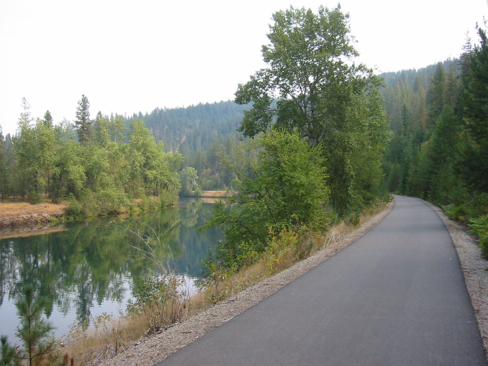
Location: Plummer trailhead, Plummer, Idaho, at the western end of the official trail. Role in the ride: assemble, check the shuttle plan and begin the eastbound crossing. What to see or do: notice the route’s transition from town into the Coeur d’Alene Reservation landscape and read posted trail guidance before rolling. Recommended stop: 10–15 minutes before departure. Distance from route: on route. Bike parking: use the signed trailhead facilities; do not assume secure overnight storage. Hours: outdoor trailhead; check current access and parking rules with Idaho Parks before riding. Practical rider note: this is the best place to confirm water, food and return transport before committing to a long point-to-point day. Image: actual Trail of the Coeur d’Alenes; Robert Ashworth, CC BY 2.0, Wikimedia Commons source page.
Location: Chatcolet, Heyburn State Park, where the trail uses the former railway trestle and swing-bridge alignment across the lake. Role in the ride: the western section’s defining panorama and the key access-status checkpoint. What to see or do: take in the long water crossing and railway engineering without blocking other users. Recommended stop: 10–20 minutes when access is open. Distance from route: on route. Bike parking: no dedicated secure racks on the crossing; keep the bicycle with you and stop only where safe. Hours: natural outdoor feature, subject to park access and construction controls. Practical rider note: 2026 marina work includes complete Monday–Thursday closures with no detour on September 15–18, 22–25 and September 29–October 2; recheck the official notice. Image: the actual Chatcolet rail-trail bridge; Robert Ashworth, CC BY 2.0, Wikimedia Commons.
Location: official Harrison trail access beside the lakeshore in Harrison, Idaho. Role in the ride: the most useful early resupply and an ideal place to reset after the lake crossing. What to see or do: walk the waterfront, photograph the lake and use town services before the quieter wetland miles. Recommended stop: 30–60 minutes, longer if eating. Distance from route: on or within a short walk of the trail. Bike parking: use any signed public rack you find and lock the bike; secure capacity is not guaranteed. Hours: trail access is outdoors; check current hours directly with any café or operator before riding. Practical rider note: buy enough food and water here to cover the remote-feeling river section. Image: actual Trail of the Coeur d’Alenes scenery; Robert Ashworth, CC BY 2.0, Wikimedia Commons.
Location: the official trail corridor near Medimont along the Coeur d’Alene River wetlands. Role in the ride: a low-key scenic pause between Harrison and Cataldo. What to see or do: watch for waterfowl and changing wetland light from the paved corridor without entering sensitive ground. Recommended stop: 10–15 minutes. Distance from route: on route. Bike parking: no verified secure racks; keep the bicycle with you. Hours: outdoor corridor with no commercial hours; seasonal or emergency restrictions may apply. Practical rider note: remain on asphalt and designated picnic areas, avoid shorelines and disturbed soil, and never drink surface water even if filtered. Image: actual Trail of the Coeur d’Alenes corridor; Robert Ashworth, CC BY 2.0, Wikimedia Commons.
Location: Coeur d’Alene’s Old Mission State Park near Cataldo, Idaho, reached from the trail’s Cataldo area. Role in the ride: the route’s strongest cultural and historical stop. What to see or do: visit the Mission of the Sacred Heart, museum exhibits and grounds, allowing time for the layered Indigenous, missionary and regional story. Recommended stop: 45–90 minutes. Distance from route: a short signed connection; confirm the official map. Bike parking: use signed park facilities and lock the bike; secure indoor storage is not guaranteed. Hours: admission facilities have seasonal schedules—check current hours with Idaho Parks before riding. Practical rider note: budget time rather than rushing this stop, and follow all park rules. Image: Mission of the Sacred Heart at the actual park; Wikimedia Commons, licensed on the source page.
Location: Trail of the Coeur d’Alenes access in Kellogg and the nearby South Fork Campground by Smelterville. Role in the ride: the most practical service and overnight zone before the final Silver Valley miles. What to see or do: refuel in Kellogg or use the state campground’s showers, potable water, secure bicycle parking and e-bike charging. Recommended stop: 30–60 minutes, or overnight for a two-day ride. Distance from route: on or immediately beside the corridor; verify the official map for the campground entrance. Bike parking: secure bicycle parking is officially listed at South Fork Campground. Hours: campground and service availability can be seasonal; check current reservations and hours with Idaho Parks. Practical rider note: the campground opened in July 2026, so rely on current official details rather than older maps. Image: actual Trail of the Coeur d’Alenes; Robert Ashworth, CC BY 2.0, Wikimedia Commons.
Location: official Mullan trailhead at the eastern end of the Trail of the Coeur d’Alenes, Mullan, Idaho. Role in the ride: finish, regroup and meet the prearranged shuttle or second vehicle. What to see or do: mark the completion of the 73.2-mile crossing and reflect on the transition from lakes and wetlands to the narrow mining valley. Recommended stop: 15–30 minutes, depending on pickup timing. Distance from route: on route. Bike parking: use signed trailhead facilities; secure or overnight storage is not guaranteed. Hours: outdoor trailhead; confirm parking restrictions and seasonal access with Idaho Parks. Practical rider note: do not arrive without confirmed transport, food and a cold-weather backup, because end-to-end transit is not dependable. Image: actual Trail of the Coeur d’Alenes infrastructure; Robert Ashworth, CC BY 2.0, Wikimedia Commons.
BEFORE YOU RIDE
Stay on the paved trail and designated picnic areas. The asphalt and gravel shoulders form an engineered clean barrier over historic mining contamination. Do not disturb soil, let children play off trail or near shorelines, or drink surface water even after filtering. Wash hands and face before eating and remove trail dirt from shoes, clothing, pets and equipment. Check the official park page immediately before departure for closures and emergency notices.
Late spring through early fall offers the most reliable riding, but exposed lake sections can be windy and the Silver Valley can be hot or smoky in summer. Thunderstorms, wildfire smoke and early or late-season cold can change conditions quickly. For 2026, Heyburn State Park marina work affects Chatcolet access; the official notice lists complete trail closures with no detour Monday–Thursday, September 15–18, 22–25 and September 29–October 2, with Friday–Sunday access expected. Recheck before riding.
Begin with adequate water and food. Services are clustered in Plummer, Harrison, Kellogg, Wallace and other towns, while the wetland miles can feel remote. Never drink lake, river or wetland water, even if filtered, because of contamination risk. Confirm seasonal fountains and business hours before relying on them.
There is no dependable end-to-end public transport for this 73.2-mile point-to-point route. Arrange a commercial shuttle, two vehicles or a supported tour before starting. Do not assume a local bus will carry a bicycle or connect Plummer with Mullan.
Use one of the signed trailheads shown on the official Idaho Parks map. Plummer, Harrison, Cataldo, Kellogg and Mullan are practical access points, but overnight rules vary. During the 2026 Heyburn marina project, Chatcolet parking and boat-launch access may be closed or restricted, so start outside the park when advised.
Walkers, skaters, bicycles, Class 1 and Class 2 e-bikes, Nordic skiers and snowshoers are allowed. Keep right, pass with an audible warning and control speed around families and wildlife. Pets must be on a leash no longer than six feet. Horses and pack stock, camping within the trail right-of-way, campfires, fireworks, hunting, trapping and firearm discharge are prohibited.
COMMUNITY PHOTOS
Community photos will appear only after real riders submit images and permission to publish their account credit.
Submit a ride ↗RELATED RIDES
 FUN 9.5↗
Glenwood Springs–Aspen, Colorado · United States
 FUN 9.0↗
Pittsburgh to Cumberland · United States
 FUN 8.9↗
New York City, New York · United States
This guide uses route information from Idaho Department of Parks and Recreation — Trail of the Coeur d’Alenes. Some catalogue images are representative of the route region. Tour de Fun is a free editorial community, not a navigation or commerce service.