Why it is worth riding
Ride the historic Main Stem of America’s pioneering rail-trail, linking Wheaton’s Mile 0 with the Forest Park Blue Line through prairie remnants and western-suburb town centers.
Ride the historic Main Stem of America’s pioneering rail-trail, linking Wheaton’s Mile 0 with the Forest Park Blue Line through prairie remnants and western-suburb town centers.
CORE INFORMATION
WHY IT’S FUN
The Illinois Prairie Path is not simply another suburban bike corridor. Created from the former Chicago Aurora & Elgin electric railroad right-of-way, it became the first successful rail-to-trail conversion in the United States and helped establish an idea now repeated across the country. For a coherent Tour de Fun ride, this page focuses on the Main Stem between Mile 0 in Wheaton and the Forest Park CTA terminal: approximately 15 miles each way, or 48 km out and back.
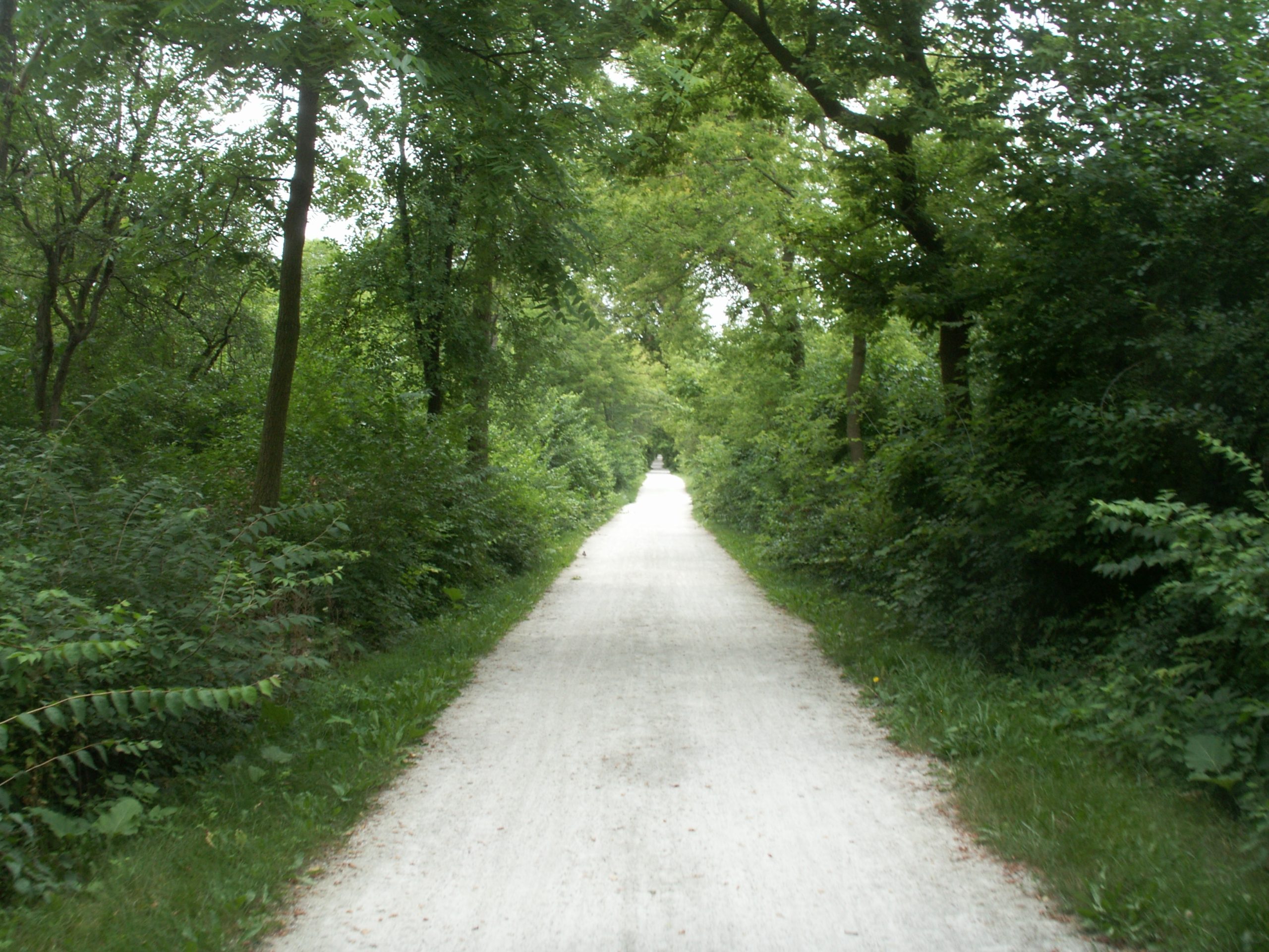
Start at the concrete Mile 0 marker near Carlton Avenue and Liberty Drive in Wheaton, where the Path’s branches converge. The opening miles feel residential and sociable rather than remote. Commuters, runners, dog walkers and recreational riders share a green corridor that slips behind gardens and neighborhood streets while the old railway geometry keeps the route direct.
Lombard provides the ride’s most charming garden interruption. Lilacia Park sits a short detour from the trail and rewards a slow lap, especially during the spring lilac and tulip season. Benches, historic structures and mature plantings make this a better pause than an anonymous convenience-store stop, while nearby downtown businesses provide food and water.
Around Villa Park, the railway story becomes tangible. The preserved Villa Avenue station—now associated with the local historical museum—recalls the interurban line that once carried passengers along this corridor. It is an excellent photo stop and a reminder that the straight, gentle alignment beneath your wheels was designed for trains rather than weekend exercise.
East of Villa Park, the experience becomes more urban. Elmhurst’s Great Western Prairie preserves a rare ribbon of native vegetation alongside the former railway, but road crossings arrive more frequently and require deliberate slowing. The section is still enjoyable; it simply changes from a leafy cruise into a lesson in how a regional trail negotiates mature suburbs.
The I-290/I-294 interchange at Berkeley is the route’s least picturesque but most important practical section. Major tollway reconstruction has affected Electric Avenue and the Prairie Path, with intermittent closures, flaggers or signed routing possible. This is not a place to improvise through barriers. Check the IPP construction-updates page immediately before departure and follow every on-site direction.
The eastern miles through Bellwood and Maywood carry a stronger working-suburb character. The 1st Avenue gateway is a satisfying marker and a good turnaround option if conditions, daylight or energy are deteriorating. Continuing to Forest Park connects the ride directly with the CTA Blue Line, creating the possibility of a one-way trip when current bicycle-carriage rules and service conditions allow.
This ride fits Tour de Fun because its pleasure comes from the sequence: prairie fragments, neighborhood gardens, railway architecture, town centers and transit history all appear along one nearly level line. It works especially well with a friend or partner who enjoys stopping to notice local details. Families can enjoy shorter sections, but the full round trip demands comfort with repeated road crossings, shared-path etiquette and changing surfaces.
Source-backed, not locally verified: This is an editorial guide, not live navigation. Check closures, detours, weather, traffic and access rules with the source immediately before riding.
Ride the historic Main Stem of America’s pioneering rail-trail, linking Wheaton’s Mile 0 with the Forest Park Blue Line through prairie remnants and western-suburb town centers.
The most memorable west-to-east sequence runs from Wheaton’s Mile 0 through Lombard and Villa Park: leafy railway geometry, Lilacia Park’s seasonal color and the preserved Villa Avenue station give the ride a distinct identity before the corridor becomes more urban.
Make Lilacia Park the relaxed scenic break, use the Villa Avenue station for the strongest railway-history photograph, and decide at Maywood’s 1st Avenue gateway whether to continue to Forest Park or turn back. Carry enough time for construction-related delays near I-290/I-294.
Best for friends, couples, touring-minded riders and confident families who appreciate rail-trail history and town-to-town variety. Beginners should choose a shorter Wheaton–Lombard or Wheaton–Villa Park out-and-back before attempting the full 48 km.
The Path follows the former Chicago Aurora & Elgin electric railroad. May Theilgaard Watts’s 1963 advocacy helped turn the abandoned corridor into America’s first successful rails-to-trails conversion, demonstrating that disused transport infrastructure could become public greenway.
ROUTE MAP
Tour de Fun does not rebuild navigation. Start with Illinois Prairie Path Not-for-Profit Corporation for the published route, map files, closures and local rules. The planning-platform links below open mature tools; they are not claimed to be the same verified track.
FUN STOPS
Start / orientation point · Carlton Avenue and Liberty Drive, Wheaton, IL 60187. The concrete Mile 0 marker identifies the convergence of the Main Stem, Elgin Branch and Aurora Branch. Recommended stop: 10–15 minutes to confirm direction and photograph the marker. Distance from route: on route. Bike parking: no verified dedicated rack; keep the bicycle with you without blocking the path. Hours: outdoor trail access; check current restrictions. Rider note: move fully off the travel line before studying the map.
Garden and scenic break · 150 S Park Avenue, Lombard, IL 60148. The historic garden is known for more than 700 lilacs and extensive spring tulip displays, benches and historic structures. Recommended stop: 20–30 minutes. Distance from route: about 0.4 km / 0.25 mi. Bike parking: use a legal rack if available and lock the bike; monitored parking is not promised. Hours: check Lombard Park District for current hours and events. Rider note: walk the bicycle where crowded and protect plantings.
Railway-history stop · 220 S Villa Avenue, Villa Park, IL 60181. The preserved Chicago Aurora & Elgin station makes the interurban story visible; the museum adds context when open. Recommended stop: 15 minutes outside. Distance from route: beside the Main Stem. Bike parking: no monitored storage promised; use a legal rack and do not attach bikes to the historic structure. Hours: limited—check current hours with the Historical Society. Rider note: keep entrances clear.
Native-prairie pause · Linear prairie remnant beside the Main Stem through Elmhurst, particularly around the Spring Road–Poplar Avenue corridor. Recommended stop: 10–15 minutes for seasonal grasses and wildflowers. Distance from route: directly beside the path. Bike parking: no verified rack; remain with the bicycle and keep it off vegetation. Hours: outdoor corridor; no commercial hours. Rider note: do not enter restoration areas, pick flowers or block crossings.
Construction-status checkpoint · Main Stem near Electric Avenue / Vallette Street at the I-290 and I-294 interchange. Read signs and identify the official passage or signed detour. Recommended stop: only as long as needed for safe navigation. Distance from route: on route. Bike parking: none; keep control of the bike outside work areas. Hours: access depends on construction. Rider note: never cross barriers; follow flaggers and turn around if no lawful route is clear.
Eastern gateway and decision point · Illinois Prairie Path entrance at 1st Avenue in Maywood, IL. Use it to reassess daylight, weather and energy before Forest Park. Recommended stop: 5–10 minutes. Distance from route: on route. Bike parking: no verified dedicated rack; keep the bicycle with you. Hours: outdoor trail access; check local restrictions. Rider note: use the marked crossing, obey signals and never assume drivers will yield.
Eastern endpoint / transit option · 711 Desplaines Avenue, Forest Park, IL 60130. Rest away from passenger circulation and use the Blue Line only after checking bicycle-carriage rules and alerts. Recommended stop: 10–20 minutes. Distance from route: endpoint area. Bike parking: use designated racks or facilities shown on site and lock securely. Hours: service varies; check CTA live information. Rider note: crowding may restrict bicycles, so retain enough energy and daylight to ride back.
BEFORE YOU RIDE
Check the official Illinois Prairie Path construction-updates page immediately before riding. The Main Stem has been affected by the Central Tri-State Tollway work around I-290/I-294 and Electric Avenue/Vallette Street; intermittent closures, flaggers or signed detours may occur. Slow at every road crossing, obey signals, keep right, announce passes and expect walkers, runners, dogs and children. Do not ride through barricades or enter an active work zone.
Spring and early autumn usually offer the most comfortable temperatures. Crushed-limestone sections can become soft, muddy or rutted after heavy rain; summer heat and humidity can be substantial, while winter ice and freeze-thaw damage may make shaded stretches hazardous. Check the forecast and recent trail notices.
Begin with full bottles. Wheaton, Lombard, Villa Park, Elmhurst, Maywood and Forest Park offer commercial resupply, but public drinking fountains are seasonal and should not be assumed operational. Carry snacks and refill in a town center before the return leg.
Wheaton, Lombard, Villa Park and Elmhurst are served by Metra’s Union Pacific West Line, while the eastern endpoint is near the Forest Park CTA Blue Line terminal. Bicycle access varies by train, time, crowding and service disruption; check current Metra and CTA bicycle policies before relying on transit as a bailout.
Use legal, signed public parking in Wheaton or another town center and verify posted time limits. Do not assume commuter lots permit all-day recreational or overnight parking. The IPP amenities page lists trail access points, but conditions and restrictions can change.
The Prairie Path is a shared non-motorized corridor. Keep right, pass on the left only after an audible warning, control speed around pedestrians and dogs, yield at signed crossings and use lights from dusk or in low visibility. Check current local e-bike rules because regulations can differ by municipality.
COMMUNITY PHOTOS
Community photos will appear only after real riders submit images and permission to publish their account credit.
Submit a ride ↗RELATED RIDES
 FUN 8.9↗
Truckee, California · United States
 FUN 9.1↗
Portland, Oregon · United States
 FUN 8.8↗
Redmond–Woodinville–Bothell, Washington · United States
This guide uses route information from Illinois Prairie Path Not-for-Profit Corporation. Some catalogue images are representative of the route region. Tour de Fun is a free editorial community, not a navigation or commerce service.