Why it is worth riding
A relaxed 16.3 km paved ride beside the Sammamish River, where suburban town centres give way to farms, wineries, salmon habitat and waterside parks.
A relaxed 16.3 km paved ride beside the Sammamish River, where suburban town centres give way to farms, wineries, salmon habitat and waterside parks.
CORE INFORMATION
WHY IT’S FUN
The Sammamish River Trail succeeds by making an ordinary suburban valley feel spacious. For 10.1 official miles—about 16.3 kilometres—it stays close to the river while moving from Marymoor Park through downtown Redmond, protected farmland and Woodinville to Bothell. The riding is technically easy, yet the surroundings keep changing enough that the route feels like a small journey rather than a fitness loop.
Start at Marymoor Park, one of King County’s great all-purpose public spaces. Before turning north, you can watch activity around the velodrome, gardens, sports fields and river launch, or simply use the park’s open lawns to organise the group. Marymoor Village light rail now provides unusually convenient car-free access, which makes a point-to-point ride far more practical than it once was.
The Redmond section mixes civic life with river ecology. Dudley Carter Park is a particularly worthwhile pause: its Haida House replica and the story of centenarian woodcarver Dudley Carter bring art and cultural history into a corridor that could otherwise be read only as transport infrastructure. Nearby trestle and trail connections recall the river and railway systems that shaped Redmond’s street pattern.
North of the city, the valley opens dramatically. Sixty Acres Park and surrounding agricultural land create long views toward the Cascade foothills, and the trail’s gentle grade invites conversation rather than concentration. This is the most memorable section on a clear day: cyclists, runners and equestrians share the corridor while working fields preserve a sense of rural space within the metropolitan region.
Woodinville changes the mood again. Wilmot Gateway Park supplies lawns, river access and a practical rest, while nearby wineries, breweries and cafes make it easy to turn the ride into a social outing. Commercial stops require a small detour and current-hours check. If alcohol is part of the day, keep it modest, eat, hydrate and remember that the trail remains a busy public route.
Beyond Woodinville, vegetation closes in around quieter river bends. Restoration areas tell an important environmental story: the Sammamish was straightened as part of a federal flood-control project completed in 1966, and contemporary work now tries to recover floodplain and salmon habitat within that altered system. The ride becomes a lesson in how cities renegotiate waterways over time.
Park at Bothell Landing makes a satisfying finish. Historic buildings, the pedestrian bridge, lawns and riverside spaces reward a final walk around before transit or return arrangements. The Sammamish River Trail also connects directly with the Burke–Gilman, so stronger riders can continue toward Lake Washington and Seattle; this guide deliberately ends in Bothell to keep the ride approachable.
Practical limits matter. This is a popular shared trail, not a private cycleway, and its flatness can tempt riders to carry too much speed. Flooding can affect low sections near NE 95th Street in Redmond, wet leaves and frost can reduce grip, and seasonal maintenance may appear with little notice. King County did not list a specific active closure on the official trail page at this review, but riders should check current alerts immediately before departure.
King County publishes the official length and surface but no definitive total-ascent figure for this exact route, so no elevation number is invented. A verified GPX, Strava, Komoot or Ride with GPS route is not supplied here; use King County’s official trail map for current navigation and do not confuse the separate 2026 East Lake Sammamish Trail culvert closure south of Marymoor with the Sammamish River Trail itself.
Source-backed, not locally verified: This is an editorial guide, not live navigation. Check closures, detours, weather, traffic and access rules with the source immediately before riding.
A relaxed 16.3 km paved ride beside the Sammamish River, where suburban town centres give way to farms, wineries, salmon habitat and waterside parks.
The open agricultural valley between Redmond and Woodinville gives the broadest sky and Cascade foothill views; the quieter river bends approaching Bothell feel the most secluded.
Take a real break at Marymoor, Wilmot Gateway Park and Bothell Landing. Dudley Carter Park rewards a slower cultural pause, while Sixty Acres is best for open-valley views.
Ideal for mixed-ability friends and families who want a long, flat shared trail without sacrificing variety. Solo riders will appreciate the simple navigation and frequent access points.
The corridor follows a river reshaped for flood control and a valley still protected for agriculture. Parks, salmon-restoration work and former rail connections reveal how recreation, habitat and transport now share the same landscape.
ROUTE MAP
Tour de Fun does not rebuild navigation. Start with King County Parks – Sammamish River Trail for the published route, map files, closures and local rules. The planning-platform links below open mature tools; they are not claimed to be the same verified track.
FUN STOPS
Address: 6046 West Lake Sammamish Parkway NE, Redmond, WA 98052. Role in the ride: official southern access and spacious start. What to see or do: explore the river edge, velodrome, gardens or historic Willowmoor area before setting off. Recommended stop: 20–40 minutes. Distance from route: On the trail’s southern terminus. Bike parking: Use designated racks where provided; capacity varies by facility. Hours: King County lists park hours as 8 a.m. to dusk; authorised activities may differ. Practical rider note: Parking currently costs $1 and large events can alter traffic and access—check the park calendar.
Location: Intersection of Leary Way and 159th Place NE, downtown Redmond. Role in the ride: first cultural pause after Marymoor. What to see or do: view the landmark Haida House Replica No. 4 and learn about woodcarver Dudley Carter’s residency. Recommended stop: 15–25 minutes. Distance from route: Directly along the Sammamish River Trail. Bike parking: Formal rack availability is not confirmed; keep the bicycle supervised or use a designated rack nearby. Hours: Outdoor park access and construction status can change; check the City of Redmond before riding. Practical rider note: Slow down where downtown paths, trail junctions and pedestrians converge.
Location: Sixty Acres Park, NE 116th Street, Redmond, WA 98052, beside the Sammamish River Trail. Role in the ride: broad agricultural-valley break. What to see or do: enjoy open fields, Cascade foothill views and the transition from city to farmland. Recommended stop: 10–20 minutes. Distance from route: Immediately adjacent via signed access. Bike parking: Rack availability is not confirmed; keep the bicycle with you unless a designated rack is present. Hours: Field schedules and access can change with sports events; check current City of Redmond or park-operator information. Practical rider note: Expect event traffic and busy crossings when tournaments are underway.
Address: 17301 131st Avenue NE, Woodinville, WA 98072. Role in the ride: central water, lawn and restroom break in Woodinville. What to see or do: rest beside the river, use picnic areas and decide whether to make a short town-centre food detour. Recommended stop: 20–35 minutes. Distance from route: Directly on the trail. Bike parking: Use designated bicycle racks if available and lock securely; current capacity is not guaranteed. Hours: Check current park hours and restroom availability with the City of Woodinville. Practical rider note: Trail and park traffic can be heavy on sunny weekends; enter the park slowly.
Location: Trail junctions serving the Hollywood District and winery area east of the Sammamish River in Woodinville. Role in the ride: optional social and food detour. What to see or do: choose one verified winery, brewery, cafe or restaurant rather than trying to sample many venues. Recommended stop: 30–60 minutes. Distance from route: Typically about 0.5–1.5 km each way depending on the operator selected. Bike parking: Facilities vary by business; confirm secure bicycle parking directly with the operator. Hours: Check current hours and reservation requirements with the individual operator before riding. Practical rider note: Do not ride impaired—food, water and a conservative tasting plan are essential.
Address: Main access at 17995 102nd Avenue NE, Bothell, WA 98011; Brackett’s Landing access is at 11101 NE 174th Street. Role in the ride: calm nature pause before the finish. What to see or do: watch the river, restored habitat and seasonal birdlife from a quiet green space. Recommended stop: 10–20 minutes. Distance from route: Direct trail access. Bike parking: Formal bicycle parking is not confirmed; keep the bicycle supervised or use a designated rack if present. Hours: Outdoor park access may be affected by maintenance or restoration work; check the City of Bothell. Practical rider note: Brackett’s Landing has limited street parking, and wet river-edge surfaces can be slippery.
Address: 9919 NE 180th Street, Bothell, WA 98011. Role in the ride: historic northern finish and Burke–Gilman connection. What to see or do: cross the pedestrian bridge, visit relocated historic buildings, lawns and the riverside; confirm Bothell Historical Museum access separately. Recommended stop: 25–45 minutes. Distance from route: Directly on the trail. Bike parking: Use designated racks where available; do not lock to historic structures or block paths. Hours: Outdoor park and museum hours differ; check current details with the City of Bothell and museum operator. Practical rider note: Arrange transit or return logistics before stopping; continuing west places you on the Burke–Gilman Trail.
BEFORE YOU RIDE
Keep right, announce passes and yield to pedestrians and equestrians. King County’s regional-trail speed limit is 15 mph unless otherwise posted. Slow at access points, bridge approaches and road crossings, and expect dogs, children, runners and fast commuters. Two short grades—east of 96th Avenue NE in Bothell and north of NE 145th Street—do not meet current ADA grade standards. Use front and rear lights in low light.
The exposed valley can be hot and sunny in summer, windy in changing weather and slippery with wet leaves in autumn. Winter rain can flood low portions of the trail, particularly around NE 95th Street in Redmond, while frost and ice may linger on shaded bridges. Check King County trail alerts and flood information before departure.
Water, food and restrooms are available at major parks and in Redmond, Woodinville and Bothell, but fountains and restrooms can be seasonal or temporarily closed. Start with full bottles and do not rely on a single facility. Winery or brewery stops should never replace hydration, and alcohol should be planned conservatively.
Sound Transit Link Line 2 serves Marymoor Village Station, connected to Marymoor Park by a new trail. King County Metro serves Redmond, Woodinville and Bothell, but routes, frequency and bicycle capacity change. Check current trip planners and bicycle-loading rules before committing to a point-to-point ride.
Marymoor Park has official parking at 6046 West Lake Sammamish Parkway NE and currently charges a $1 parking fee; park hours are 8 a.m. to dusk. Official access parking is also identified by King County at Wilmot Park and other trailheads. Bothell Landing has paved and gravel parking. Check posted limits, events and closures, and leave no valuables visible.
Non-motorized trail users are permitted; equestrians are specifically allowed between NE 175th Street in Woodinville and Marymoor Park, with a parallel soft-surface path. Keep right, yield appropriately and obey posted 15 mph limits. E-bike rules can change by class and jurisdiction—check current King County guidance.
COMMUNITY PHOTOS
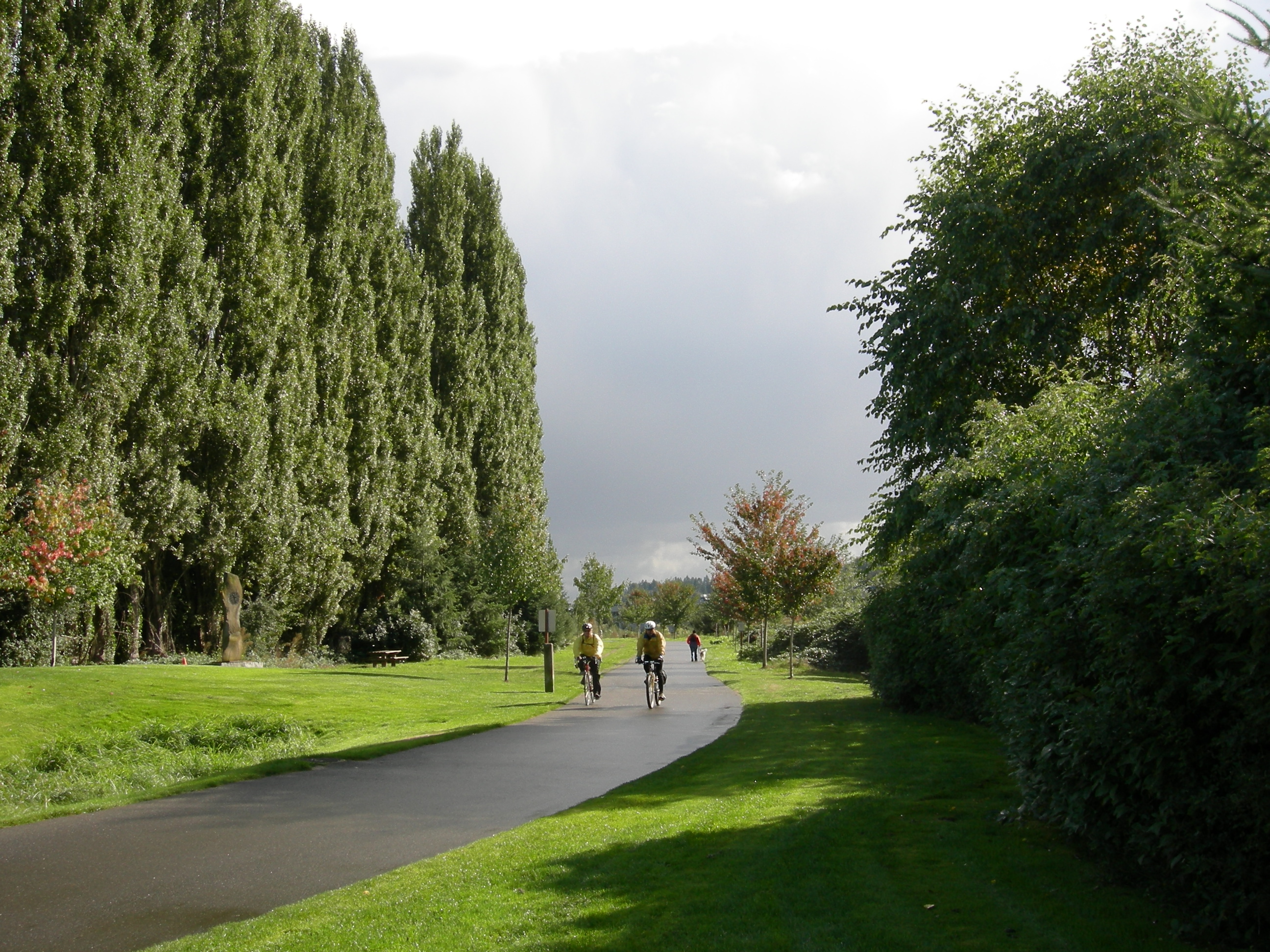
Community photos will appear only after real riders submit images and permission to publish their account credit.
Submit a ride ↗RELATED RIDES
 FUN 9.1↗
Albuquerque, New Mexico · United States
 FUN 9.0↗
Kansas City to Windsor, Missouri · United States
FUN 9.2↗Cincinnati to Springfield, Ohio · United States
This guide uses route information from King County Parks – Sammamish River Trail. Some catalogue images are representative of the route region. Tour de Fun is a free editorial community, not a navigation or commerce service.